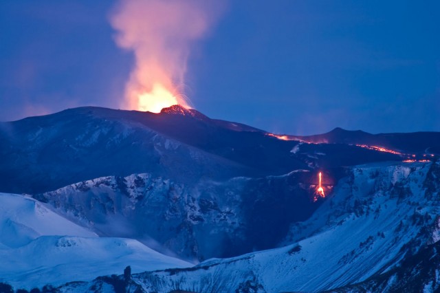
Undersea Mountain Range explained


What is an underwater mountain range called?


Related image

Question:

What is an underwater mountain range called?
Image result for Undersea Mountain Range

Mountain Ranges:

Mountain ranges are formed by different geologic processes, tectonic plates being one of them. When these plates move together, they push against each other and move upwards to create mountains. In certain areas, tectonic plates move apart, allowing magma to flow to the surface of the Earth. As it cools, it hardens and can form mountains and volcanoes.
Mid-ocean ridges are mountain ranges that are found underwater.
Tectonic plates that are underneath the ocean move apart and allow magma to flow through them. As the magma cools, it creates underwater mountains. There are many such underwater mountain ranges. Two of the most well-known are called the Mid-Atlantic Ridge and the East Pacific Rise. Although the majority of mid-ocean ridges are underwater, a small stretch of the mid-ocean ridge near Iceland actually is above sea level.
Mid-ocean ridges are hosts to unique ecosystems. Where the ocean water leaks through cracks in the ridge, the water becomes very hot; these areas are called hydro-thermal vents. In these hydro-thermal vents, the water can exceed temperatures of 700 degrees. Food chains that originate in the vents begin with microbes that can withstand these extreme conditions and expand outwards to include hundreds of organisms surviving off the warmth of the waters and each other.
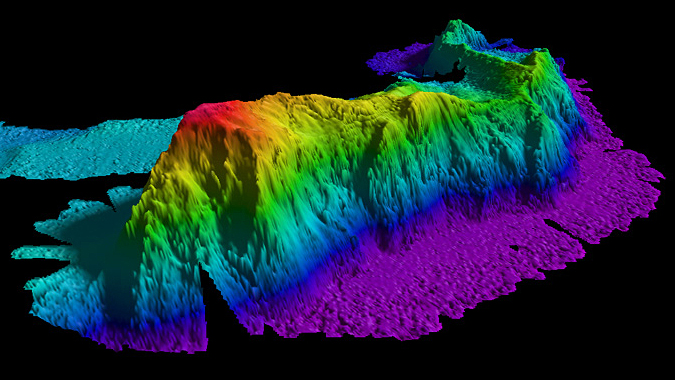
Image result for Undersea Mountain Range

Comments

Popular posts from this blog

Renuka Ji dam project : Union minister inks agreement

Renuka Ji dam project : Union minister inks agreement  Six states--Haryana, Himachal Pradesh, Uttarakhand, Delhi, Rajasthan and Uttar Pradesh--on Friday signed an agreement for construction of Renukaji Dam Multi-Purpose Project in the presence of Union Water Resources Minister Nitin Gadkari. Chief Ministers ML Khattar, Jairam Thakur, TS Rawat, Arvind Kejriwal, Ashok Gehlot and Yogi Adityanath signed the agreement. Three projects are proposed to be constructed on the Yamuna and two of its tributaries, Tons and Giri, in the hilly regions of Uttarakhand and Himachal Pradesh of the Upper Yamuna Basin. These include Lakhwar project on the Yamuna in Uttarakhand, Kisau on the Tons in Uttarakhand and Himachal, and Renukaji on the Giri in Himachal. The states had already signed an agreement in respect of sharing of cost and benefits of Lakhwar project in August 2018. After signing the agreement, Gadkari said an agreement among the states concerned regarding the Kisau project wou

India’s heaviest satellite GSAT-11 is aloft in space from Kourou

Weighing about 5,854 kg, the GSAT-11, built by ISRO, is to enable much faster Internet services than now to users down home over the next 15 years. As most of India slept, its heaviest and most advanced communication satellite, GSAT-11, was shot to space from a European spaceport in faraway South America. The mission of the 5,854-kg giant 'bird' is to enable much faster Internet services than now to users down home over the next 15 years. GSAT-11 was launched from the Guiana Space Centre at Kourou in French Guiana at 2.07 a.m. IST on Wednesday, December 5. The large high-throughput satellite (HTS), along with two smaller HTS satellites GSAT-19 and GSAT-29 launched earlier (by ISRO from Srihsrihkota) will kick off effective satellite-based broadband services in remote, hitherto uncovered rural areas of the country. These and a few more upcoming HTS fleet will also innovatively enable the use of the superior and efficient Ka frequency band. The lift off of GSAT-11  a