India’s heaviest satellite GSAT-11 is aloft in space from Kourou

Image result for gsat 11 satellite

Weighing about 5,854 kg, the GSAT-11, built by ISRO, is to enable much faster Internet services than now to users down home over the next 15 years.

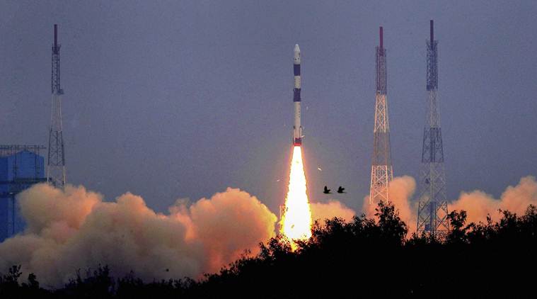
As most of India slept, its heaviest and most advanced communication satellite, GSAT-11, was shot to space from a European spaceport in faraway South America.
The mission of the 5,854-kg giant 'bird' is to enable much faster Internet services than now to users down home over the next 15 years. GSAT-11 was launched from the Guiana Space Centre at Kourou in French Guiana at 2.07 a.m. IST on Wednesday, December 5.
The large high-throughput satellite (HTS), along with two smaller HTS satellites GSAT-19 and GSAT-29 launched earlier (by ISRO from Srihsrihkota) will kick off effective satellite-based broadband services in remote, hitherto uncovered rural areas of the country. These and a few more upcoming HTS fleet will also innovatively enable the use of the superior and efficient Ka frequency band.
The lift off of GSAT-11 and a South Korean co-passenger satellite on European pace vehicle Ariane 5 VA246 was watched and cheered by the Chairman of Indian Space Research Organisation K. Sivan. In his post-launch remarks Dr. Sivan said: "It will meet most of the requirements of providing broadband connectivity to rural and inaccessible village panchayats under BharatNet which is part of the Digital India initiative."
With him at the space port were P. Kunhikrishnan, Director of the U.R.Rao Satellite Centre in Bengaluru which built the satellite; GSAT-11 Mission Director P.K. Gupta and many ISRO engineers who accompanied the satellite from Bengaluru to Kourou in late October. 
GSAT-11, described by the space agency as a giant satellite, is the heaviest ever built by ISRO. (Its next biggest is the GSAT-17, weighing 3,477 kg and which was also launched for ISRO in June 2017 by the same European launch operator Arianespace.)
The new 'big bird' adds 40 more transponders, 32 in the Ku band and eight in the Ka band being introduced newly in an Indian satellite. Indian Internet users are estimated at over 450 million, apart from various businesses, bank ATM services and public organisations, with a growing appetite for ever speedier and better broadband services. 
Enabling in-flight Internet and village web services are the government's other goals. By enabling rural high-speed connectivity the HTS satellite also promises to bridge the urban-rural digital divide.
The space agency described GSAT-11 as a "forerunner in the series of advanced communication satellites with multi-spot beam antenna coverage" over the mainland and islands. "GSAT-11 will play a vital role in providing broadband services across the country. It will also provide a platform to demonstrate new generation applications."
Comments

Popular posts from this blog

Renuka Ji dam project : Union minister inks agreement

Renuka Ji dam project : Union minister inks agreement  Six states--Haryana, Himachal Pradesh, Uttarakhand, Delhi, Rajasthan and Uttar Pradesh--on Friday signed an agreement for construction of Renukaji Dam Multi-Purpose Project in the presence of Union Water Resources Minister Nitin Gadkari. Chief Ministers ML Khattar, Jairam Thakur, TS Rawat, Arvind Kejriwal, Ashok Gehlot and Yogi Adityanath signed the agreement. Three projects are proposed to be constructed on the Yamuna and two of its tributaries, Tons and Giri, in the hilly regions of Uttarakhand and Himachal Pradesh of the Upper Yamuna Basin. These include Lakhwar project on the Yamuna in Uttarakhand, Kisau on the Tons in Uttarakhand and Himachal, and Renukaji on the Giri in Himachal. The states had already signed an agreement in respect of sharing of cost and benefits of Lakhwar project in August 2018. After signing the agreement, Gadkari said an agreement among the states concerned regarding the Kis...

Undersea Mountain Range explained

What is an underwater mountain range called? Question: What is an underwater mountain range called? Mountain Ranges: Mountain ranges are formed by different geologic processes, tectonic plates being one of them. When these plates move together, they push against each other and move upwards to create mountains. In certain areas, tectonic plates move apart, allowing magma to flow to the surface of the Earth. As it cools, it hardens and can form mountains and volcanoes. Mid-ocean ridges are mountain ranges that are found underwater. Tectonic plates that are underneath the ocean move apart and allow magma to flow through them. As the magma cools, it creates underwater mountains. There are many such underwater mountain ranges. Two of the most well-known are called the Mid-Atlantic Ridge and the East Pacific Rise. Although the majority of mid-ocean ridges are underwater, a small stretch of the mid-ocean ridge near Iceland actually is above sea level. Mid-ocean ridg...
  NORTH SENTINEL ISLAND An American visiting one of the islands in India’s remote cluster of Andaman and Nicobar has been killed by a group of hunter-gatherers who live there isolated from the outside world NOTES The North Sentinel Island is home to the Sentinelese community, who allegedly killed the American, identified as John Allen Chau, after he was illegally ferried there by fishermen THE NORTH SENTINEL ISLAND North Sentinel Island is inhabited by a group of indigenous people, the Sentinelese. Their population is estimated to be between 50 and 400 individuals. They reject any contact with other people, and are among the last people to remain virtually untouched by modern civilization. IS IT LEGAL TO GO THERE? North Sentinel Island is about 50 km west of Port Blair, the capital of the island cluster. The Times of India reported in August this year that the Ministry of Home Affairs had relaxed the restricted area permit foreigners needed to travel to 29 islands in Andaman and ...